Call me old fashioned. Call me a Luddite. But don’t call me lost, because I know how to read a map and compass. When I 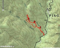 served my country years ago they decided that a fine young Marine like myself should know how to read a map and compass, so that if I went behind enemy lines I wouldn’t get lost. Later on I worked in an FDC (Fire Direction Center) where compass work was my lifeblood. I learned how to plot azimuths, intersections and resections and other interesting and arcane land navigation secrets. They showed us how to convert a grid azimuth to a magnetic azimuth and vice versa.
By Jarhead Survivor, a contributing author
Don’t know what that means? Keep reading. Why go through all the trouble of learning this when there’s a GPS on every smart phone and in every pack these days. The compass is outdated right? Wrong.
Fundamental Understanding
The first thing you need to know about using a map and compass is that there’s a lot to learn and some of it can be tricky. Another thing you’ll need to understand is the pace count, which I’ll discuss in a bit. When you use a map and compass you do it for one of several different reasons. You need to move from point A to point B accurately and efficiently, or you’re not quite sure where you are, but if you look at the map long enough you should be able to pick out where you are using terrain association. You might want to plot a course over unfamiliar terrain and the map is a perfect place to do that.
In order to do these things you need to have a fundamental understanding of how these systems work together. Once you have the basic understanding of how to use a map and compass you will never get lost again. Oh, you might get a little misplaced for awhile, but not lost.
Also Read: Navigating with a GPS & Compass
A few years ago I went hiking with a friend of mind over unfamiliar terrain. We crossed over at least three mountain peaks  during our hike and he was guiding us using his newly won GPS unit. (He won it a conference in Boston.) He was holding it up as the shining light of land nav and I was suitably impressed. We got to our destination and after awhile I asked him to reprogram it to take us home. He said, “Huh?” He had no idea how to operate it! He’d made a few waypoints, but really had no idea how to use it.
Luckily I had brought my map and compass (you’ll find me in the woods naked before you see me without a map and compass) and I was able to plot a course to get home. But what really got me was that he no idea how to read a map and compass either. He was completely lost! I could sort of understand how he might have got caught up in the excitement of new technology, but going out into the wilderness like that without the basic understanding of how to navigate was unforgivable. That’s how people get lost and sometimes get dead.
Once you have a fundamental idea of how land navigation really works then the move sophisticated tools like the GPS you use are great and might help improve accuracy, but you won’t really need them in order to get where you’re going.
Lowest Common Denominator
Having a basic understanding of how to shoot an azimuth (direction) and read a map could save your life some day. Knowing how to use these two items together plus knowing your pace count is critical.
The pace count is a rough way of measuring distance when you’re walking. The way I figured out my pace count was taught to me in basic training. They took us to a 100 meter course (the military does all Land Nav in the metric system) and made us walk it about ten times. We walked it at a normal pace without hurrying and counted every time our left foot struck the deck. My pace count is 63 steps, so every time I count 63 (or 73 in rougher terrain) I reach up and pull down one of my Ranger Beads to keep track of my pace.
GPS
After all this talk of the map and compass you probably think that I hate the GPS. Nothing could be further from the truth. I’ve pulled out my smartphone on many occasions and checked it for my location, which can sometimes be useful and sometimes not, but it’s a fantastic piece of gear to have. When hunting I’ve used it see how far that swamp extends, or when hiking to see what’s over the next peak without actually having to hike up there and look.
In the city they can’t be beat. “Turn left. Turn right. Bear left at the next intersection.” Beautiful stuff! Especially if you don’t know the city. I used my smartphone with Google maps today in Bangor and it saved me a ton of trouble.
But with the good comes the bad and one of the things that bothers me about the GPS is that it’s electronic and thus dependent on electricity. I’ve been in the field enough to know that batteries wear down and you don’t always get an immediate resupply. Imagine life after a solar flare or an EMP attack or whatever might bring the grid down. If you’re depending on your electronic gizmo to get you to your bug-out location you might find yourself in a dire situation.
The GPS is awesome when it works, but it’s sometimes been my luck that just when I need some electronic device the most, is exactly when it will fail. Case in point – I was once hiking through the 100 Mile Wilderness in Maine and broke my ankle 40 miles in. Could I get my cell phone to work. Hell no! Another time I was trying to login to my bank account in Canada to transfer funds while trying to pay for a room in the hotel lobby. Could I connect to my bank? Hell no!
My suggestion would be to trust your equipment as far as you can, but have a manual backup for it just in case. That way when Murphy rears his ugly head you’ll have a backup plan and won’t wind up lost in the middle of a big forest somewhere with annoyed rescue workers trying to find you.
Questions? Comments?
Sound off below!
-Jarhead Survivor
Photos by:
[Martin]
15th MEU
NC Hiker
14 comments
A friend of mine was an SR71 pilot and once described to me what it was like to navigate while flying. Remember, this was many years before GPS. While some some electronic navigation aids were used like those on ballistic missiles and star charts, nothing beat a good old map.
However, the SR71 could only fly supersonic about 90 minutes before it needed refueling. That was a pretty small margin of error given you had to drop out of high elevation flight from 40 miles per minute to low elevation slow flight and there better be a refueling tanker waiting for you.
My friend told me, “You’ve never been lost until you you’ve been lost at Mach 3!”
Yeah, I’m not usually moving faster than 3 mph on the ground. Mach 3 could get exciting.
AMEN!!! I’ve had a GPS lie to me enough times to never fully trust them. Last weekend I was headed to a jasper deposit I’d marked two years before. Being familiar with the terrain, I could tell we were going off course. My buddy put the coordinates in his GPS and his took us about 400 feet away. We could not have found our destination with either GPS. Here’s some info from a professional navigator about setting your GPS up for the backcountry https://www.survivalcommonsense.com/five-steps-to-assure-gps-accuracy-in-the-fieldfeed/
And check out Blake’s other navigation posts: https://www.survivalcommonsense.com/category/gps-tips-from-blake-miller-land-navigation-expert-and-wilderness-survival-instructor/
Gosh is it hard to convince people that their GPS or smartphone isn’t fail-proof. I just had this conversation with a friend. I was preparing a BOB for him and gave him a compass, he just looked lost. I showed him some basics and he still didn’t understand the need. So why bother? Because he’s a friend and I can’t help but try and convince him of the need to be a little prepared.
I like your friends quote Doc.
I couldn’t agree more. I’ve never had a GPS, Just didn’t want to spend the money, but I have a first rate lensatic compass, I teach land nav to USN Sea Cadets at Camp Ripley, MN, and as you, I might have been a little misplaced once or twice, I am never lost.
Semper Fi
Hey i just joined the Commodore Perry division of sea cadets and I’m looking at the advanced trainings and I’m wondering if land ops and land navigation are similar or different.
Hi Lance,
The basics are the same, but on the sea you have to take into account tide and wind. These can cause you to drift one way or the other and you have to account for it in your calculations.
Ok thanks jarhead survivor
It’s a dying art, Woodchuck. Pretty soon there will about five of us left who know how to use it! I think I’m going to start a class in my area to teach land nav and basic wilderness survival.
Good points, Jarhead. I learned the fine points of Land Nav back in a LRS unit almost twenty years ago when a GPS wouldn’t give you much more than a “You are here” grid reference. The next generation ones often tried to get me to turn right into the next flooded field or down into a ravine. Granted, the ones these days are significantly better, but you are still just a cracked screen away from being lost as hell. Best to have the old paper backup. They weigh next to nothing in your pack, tuck away easily in your vehicle, and I’ve never heard anyone say they wish they’d left the map behind.
though I’m ashamed to admit it, I did ask for directions once.
… but never again.
Now I have a map for that. (and every street in this corner of the state)
I would prefer to have all three. Always have a backup.
Oh but the gps never is wrong or fails! RIGHT!!! What I need to know is it ever too late to learn ole school ways to be able to dump the techie world. What I would like to know is where can I locate good maps for the state of Oklahoma? Besides roads, towns, rivers, creeks, and topical what else would need to be on the map? Counties? Using a map and compass is something I’ve always want to learn but I never have had the time until now.
O_G