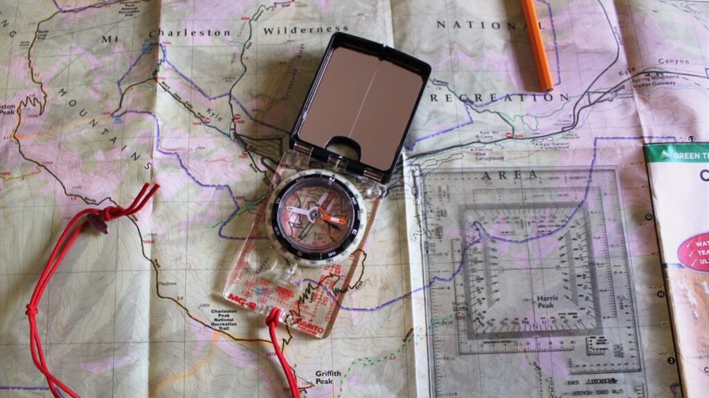
A compass is part of the 10 essentials (food, water, fire, first aid, knife, sun protection, insulation, shelter, illumination, and navigation) recommended for outdoor excursions. It is so small and light there is no excuse not to carry one.
by J. Bridger, contributing writer
Obviously, a compass does you no good if you don’t know how to use it. It also does no good if you don’t practice with it and understand how it works and its limitations. If you’re in the market for a do-it-all compass, check out the Suunto MC-2 Global Compass.
Suunto MC-2 Global Compass Review
This compass is accurate and rugged. Review over.
What else could you want? As it turns out, there are a ton of features that make your life easier. What makes this compass unique is you can use it in the northern and southern hemispheres.
To make this possible Suunto magnetized, there is a small disk that attached to the needle instead of just the needle itself. The MC-2G weighs 2.6 oz and is about 2.5” wide and 4” long when closed. It opens and closes with a tactile click. It has three small rubber feet on the bottom to prevent it from sliding around on a map.
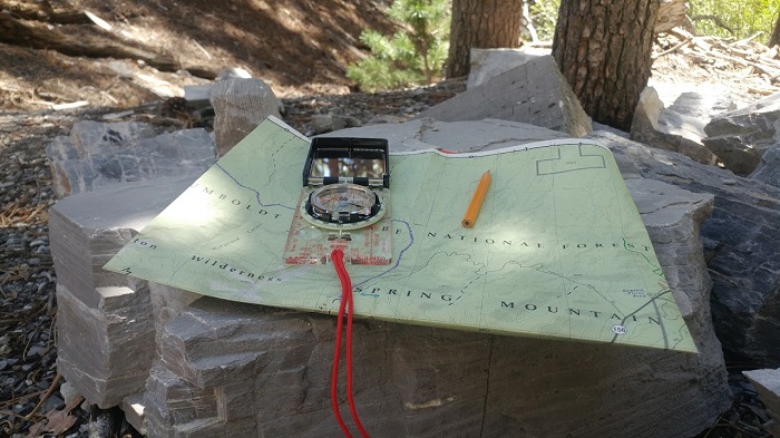
There is a magnifying lens built into the base for discerning small details on your map. I haven’t tried using this like a Fresnel lens to start a fire, but I would like to. It is small, maybe the size of a dime. The compass features an inclinometer, that you can use to measure the angle of slopes.
If you remember your high school trigonometry, you can also use this to measure the height of trees by their shadows and other things. The oil-filled bezel rotates and glows in the dark. There is a notch and small cut out so you can get an accurate sight picture and get a solid bearing on an object. There are gridlines on the rotating bezel that you can use to line up the compass on a map.
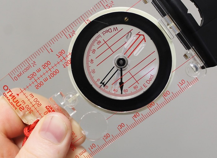
I believe on the newer models Suunto has added a logo here that shortens these gridlines. That was a poor move. There are two rulers, one in millimeters and one in inches. This model has two scales in 1:50,000 and 1:25,000. Some of my maps are 1:24,000 or 1:63,360, so I usually carry a separate UTM grid reader.
This doubles as a compass I can use to plot lines on my map. Unless you live along the agonic line, you will need to adjust the magnetic declination. The compass includes a small tool to do this. You could also use a very small flat head screwdriver, similar to one you would use for eyeglasses.
Favorite Feature – Signal Mirror
One of my favorite features about this compass is the mirror. A signal mirror is the best low tech daytime signaling device.
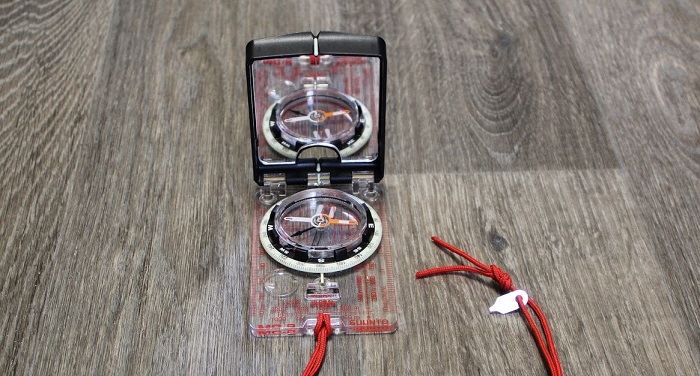
It’s estimated a flash from a mirror can be seen for up to 100 miles. If you’re trying to signal a SAR pilot, this may be your best shot. You can use it to assess injuries to your face or teeth, and to reflect light into caves or holes.
When I was an engineer, I inspected a lot of foundation piers. These were deep holes drilled into the earth, 18” to several feet in diameter. They were used to support the foundation of commercial buildings or houses. I couldn’t find a light bright enough to see the bottom of the piers, but using a handheld mirror, I was able to reflect sunlight into the deepest piers, allowing me to see the bottom.
Some people prefer a compass with no mirror, and that’s fine. I think having a mirror on your compass is genius. If I’m lost, I want to know where I’m going, where I am, and I want to be able to signal SAR. A compass with a mirror lets me do exactly that, and I don’t need to carry a separate purpose made device for signaling.
Orienteering and the Suunto Global Compass
When I check this compass against my tiny thumb tac compass, handheld GPS compass, and smartphone compass, they all agree. I’ve used the MC-2G in several places.
In Buckskin Gulch, the 16-mile slot canyon taught me how worthless a map and compass can be when you can’t see anything other than canyon walls. In Escalante, I used it to keep oriented when I wasn’t able to see the sun from another nightmarish canyon.
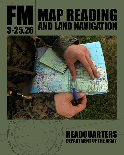
I’ve gotten the most use from it in the Spring Mountains in southern Nevada. There are enough peaks here, it is the perfect place to practice shooting azimuths and triangulating your position on a map. Orienteering is a good skill to know but can be difficult if you don’t have a place with good landmarks to shoot off of. If you are new to map reading and land navigation, I highly recommend the book of that name – Map Reading and Land Navigation.
Few Complaints
My biggest complaint is when at high altitude or low temperatures, a bubble appears in the oil used to dampen the needle. I haven’t had any problems because of this but I fear it could affect accuracy. I’ve only had this problem around 12,000 ft, but it always disappears when I go back down in elevation and to warmer temperatures. Reading reviews on Suunto’s website, it seems this is a common problem with this compass.
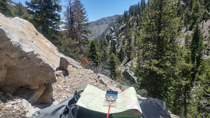
A compass isn’t a magic bullet. Just having it doesn’t guarantee you won’t get lost. You should put in the time to learn basic navigation techniques, which really isn’t that difficult. You must understand how it works and its limitations. Trails disappear, GPS fails, batteries die. If you’re looking for a compass that will do everything you need it to without spending $300, the Suunto MC-2 deserves consideration. You can buy one right here.
But that’s just my opinion. What compass do you use?
