This post may not be entirely ON topic, preparedness-wise anyway … unless I stretched it, pitched the post as…
Exercise All Year Long to Stay Apocalypse-Ready, or …
Breathe Fresh Air Today Because the World Might End Tomorrow, or …
you get the idea.
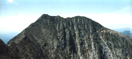
Instead I’m just going to talk a bit about this year’s winter hike up Mount Katahdin in Baxter State Park, Maine’s highest peak.
Baxter State Park used to regulate winter hiking, but they loosened the rules up a few years ago making it easier for climbers to get into the park for a winter ascent up Katahdin. A detailed “how” to climb Mount Katahdin in the winter post would be more like a series of posts, and if this was a hiking blog, I’d write it that way. Instead I’ll give you over-simplified version – with pictures.
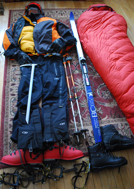
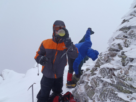
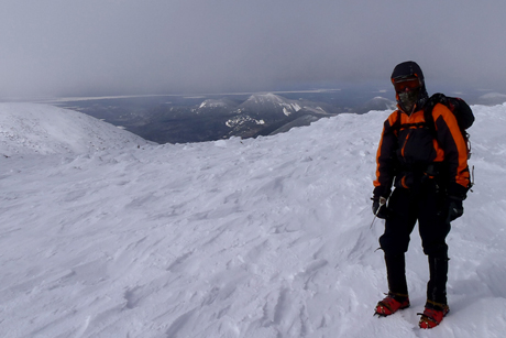
The first thing is having the right gear. The pic above doesn’t include all of the gear I took on the trip, but it does give you southern flatlanders an idea of what type of clothes is required. The biggest problem with winter hiking gear is the price. The gear pictured, from jacket, to helmet, to sub-zero sleeping bag, ice axe, etc., it wasn’t purchased for this hike. It was purchased over a course of years. Bit by bit, each piece adding to my collection and getting used for lesser hikes along the way. Remember seeing those pink boots before? Hello! I wrote about them 4 years ago – Survival Footwear – Prepare Like a Woman.
The second thing is being in shape. You have to be in moderately decent shape to hike Mount Katahdin in the summer, let alone in the winter when the park is closed to vehicle use and you have to SKI in to the base of the summit. You get a workout before you even get there!
The third thing is finding hiking partners. You could climb it yourself if you know what you’re doing, but … why? Shit can go wrong on a mountain in the winter.
There are a few ways to get to the peak, the longer route that takes you up through the scenic Chimney Pond area or the faster route that takes you through Abol Campground. Because the three of us going all have full-time jobs and limited vacation time, we opted for the fast route, drove up on a Friday night after work, in the dark, and slept in a remote parking area off a dirt road, a.k.a. “Base Camp.”
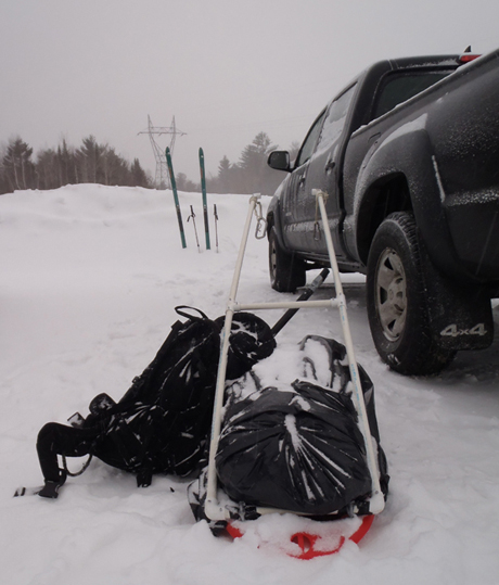
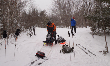
The weather was nasty the next day, half snow/half freezing rain. We had to cross country ski (with makeshift sled hauling gear attachment things). There I am in the orange/grey jacket fixing my sled.
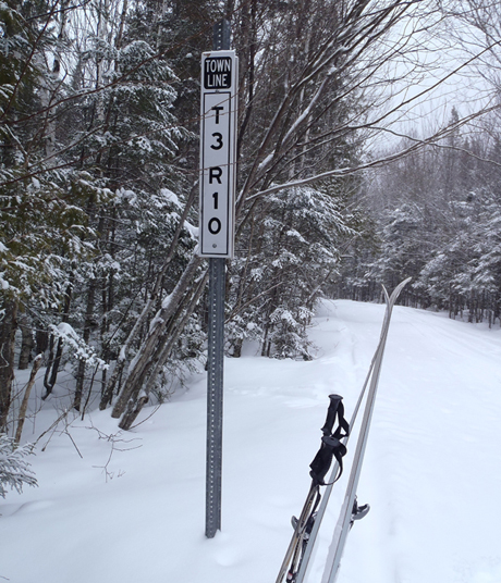
We traveled through areas where the uninhabited “towns” go by numbers, like Township 3 Range 10.
We kept skiing all the way to Abol Campground and our reserved, open-air lean-to.
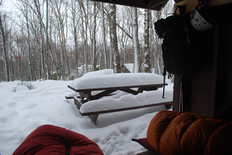
There we took a nap Saturday afternoon, woke up, stretched, fetched water and made a healthy dinner of macaroni and cheese with tuna. Mmmmm! The next morning we climbed up through the forest and approached the mountain.
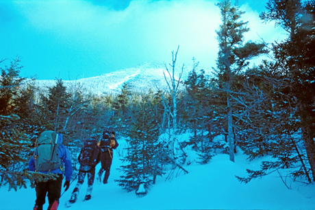
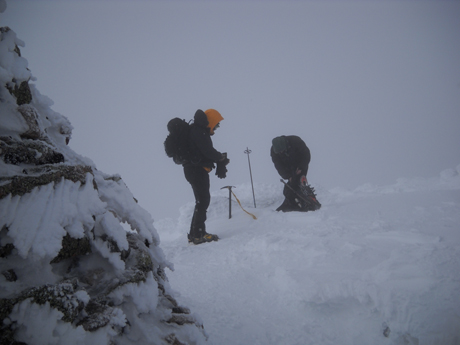
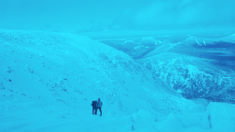
You’ll see that a few of the pics posted here have the blueish tint to like the one above. I took those pictures from a disposable camera that … didn’t work so well in the cold. But we climbed, and climbed up to Abol Slide where we had to stop to strap on crampons.
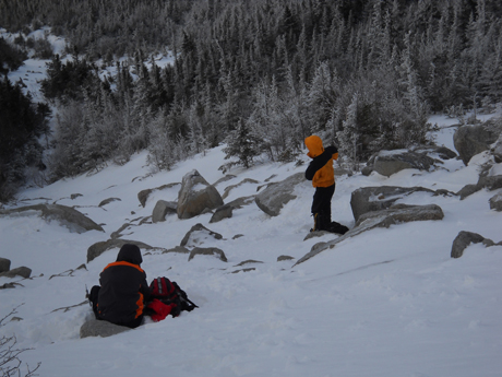
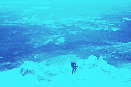
We climbed higher up the slide.
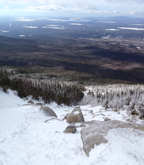
From there the view dropped off entirely, visibility was cut down to “not much” and we pressed on from cairn to cairn all the way to the summit.
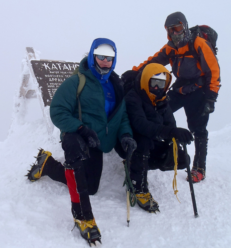
We didn’t stay on the peak long, because …. well, because it was cold!
I hiked with my homeboy Rabid Outdoorsman.
You can watch his VIDEO FROM THE PEAK.
Then typical of mountain weather, after we began our descent, some of the clouds broke long enough for sporadic views.
We hiked all the way up, down and out that Sunday, driving all the way home. We were up at about 5am and home by around 8pm. Hiking Katahdin that way makes for a long day, but one you won’t forget.
BTW: Read Rabid’s account of the hike for another take.
10 comments
That’s awesome! I’ve hiked Abol in the summer and it’s a pretty tough climb then. I’d kill to do a winter hike up Abol! Did you have to use ice tools or did you just take an ice axe?
Just an ice axe.
“I’d Kill to do a winter hike up Abol” . . . looks like next years Katahdin mountaineering team just gained a new member. Hopefully he won’t forget the Jagermeister!!
I bet he’d remember the Jager, and know not to rely on a GPS reading to get back down.
If I can break away I’d love to do it. I haven’t used my ice gear in at least two years now!
That was really cool to read & see, pardon the pun. The video did not appear on Rabid’s blog for some reason but would love to see it.
This kind of stuff to me is what clarifies life & clears the brain from the day in & day out crap we’ve gotta endure with the media et al. I was an extreme surfer & can relate to this type of thing & can see you guys understand quality equipment all the way down to the Jaegermeister!
Absolutely fantastic!
That blue tint in the pictures is probably from ultraviolet, which is stronger at higher elevations. You can get filters for it, but I’ve never bothered. Anyway, magnificent scenery.
Great article. I really enjoy share for my friends and post on my blog. This article is very remarkable. Well Done!!!
Is that the place where the wind is so bad near the top that the icicles are going sideways ?
Thanks a very good advice and comments how to get to the summit…… good pics